Spatial Information Technology – Geography Class 12 Notes
Part C: Practical Work in Geography
Chapter – 4
Spatial Information Technology
1. Introduction
Spatial information is information related to locations on the earth’s surface (where something is) together with its attributes (what it is). Spatial information technology includes the tools used to collect, store, analyse and display such information: Geographical Information System (GIS), Global Positioning System (GPS) and remote sensing.
2. Geographical Information System (GIS)
A GIS is a computer-based system for capturing, storing, checking, analysing and displaying data related to positions on the earth. It links maps (spatial data) with tables of information (attribute data).

Advantage of GIS | Example |
|---|---|
Handles large amounts of data quickly | Census data of all villages of a district |
Combines different types of data | Overlaying soil, slope and land-use maps |
Easy updating | New roads added without redrawing the whole map |
Supports decision making | Choosing sites for schools, hospitals or dumping grounds |
3. Spatial Data Formats: Raster and Vector
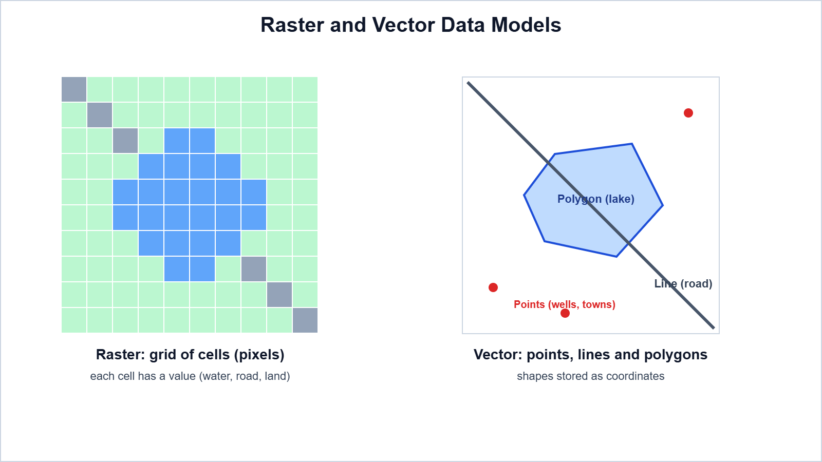
Basis | Raster | Vector |
|---|---|---|
Structure | Grid of cells (pixels), each with a value | Points, lines and polygons defined by coordinates |
Examples | Satellite images, scanned maps | Roads, rivers, boundaries, wells |
Advantages | Simple structure; good for continuous data like elevation | Precise; less storage; good for networks and boundaries |
Limitations | Large files; less precise boundaries | Complex structure; not ideal for continuous surfaces |
4. GIS Operations: Overlay and Buffer
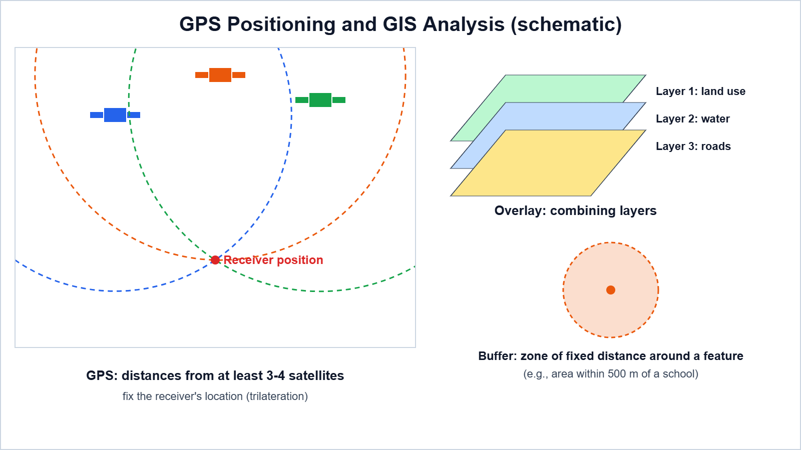
Overlay analysis combines two or more layers of the same area to find relationships, e.g., overlaying slope, soil and rainfall layers to find land suitable for apple orchards. Buffer analysis creates a zone of a fixed distance around a point, line or area, e.g., all villages within 2 km of a highway, or a 100 m zone along a river where construction should be restricted.
Other operations: proximity analysis (finding the nearest facility) and network analysis (shortest route along roads).
5. Global Positioning System (GPS)
GPS is a satellite-based navigation system that gives the exact location (latitude, longitude and altitude) and time anywhere on earth. A GPS receiver measures its distance from several satellites and finds its position by trilateration; at least three satellites are needed for a position, and four for an accurate three-dimensional position. India has developed its own regional navigation system called NavIC.
Uses: navigation of vehicles, aircraft and ships, mapping and surveying, disaster management, tracking and mountaineering.
6. Remote Sensing
Remote sensing is the collection of information about objects without being in physical contact with them, usually by sensors on satellites or aircraft that record reflected or emitted electromagnetic energy.

Uses: mapping land use, monitoring crops and forests, studying glaciers and snow cover in the Himalaya, flood and landslide mapping, urban planning and weather forecasting. India’s IRS satellites and Cartosat series provide such data.
Exam point: Remote sensing captures the data, GPS gives the exact location, and GIS analyses and displays the data.
7. Important Questions
Q1. What is spatial information?
Ans. Information about locations on the earth together with their attributes.
Q2. What is GIS?
Ans. A computer-based system to capture, store, analyse and display data related to positions on the earth.
Q3. Name the components of GIS.
Ans. Hardware, software, data, people and methods.
Q4. Distinguish between raster and vector data.
Ans. Raster uses a grid of cells; vector uses points, lines and polygons defined by coordinates.
Q5. What is overlay analysis?
Ans. Combining two or more layers of the same area to study relationships.
Q6. What is a buffer? Give an example.
Ans. A zone of fixed distance around a feature, e.g., the area within 500 m of a school.
Q7. How does GPS find a location?
Ans. By measuring distances from several satellites (trilateration).
Q8. What is NavIC?
Ans. India’s own regional satellite navigation system.
Q9. What is remote sensing?
Ans. Collecting information about objects from a distance using sensors.
Q10. Give two uses of remote sensing.
Ans. Crop monitoring and flood mapping (also forest, glacier and urban studies).
Easy Memory Trick: “See-Locate-Analyse” = Remote sensing sees, GPS locates, GIS analyses.
Conclusion: Spatial information technologies – GIS, GPS and remote sensing – have transformed geography. They help collect accurate data, find exact locations and analyse spatial patterns for planning and management.